Sunday, June 14, 2015

Arizona - Navajo Mountain Erupted? - Navajo Bridge - Marble Canyon, Old Cliff Dwellers Lodge - Off Road Distraction - Grand Canyon North Rim - Our 4th grandchild will be here a little early

This looks like a volcano just erupted, it's just clouds.
It's Navajo Mountain, 10,348' tall.


As we head to the North Rim of the Grand Canyon the first place we stopped was the Navajo Bridge Interactive Center. The first bridge is really small.
They built another bridge to support more traffic.
Here's Kathy on the old bridge.


Looking at the Colorado River


Flying down the road


Stop here!, it's part of the Roadside America Oddities.


Evidently somebody built a house around a rock.


Amazingly enough people took it upon themselves to write all over it.


for more information click here on roadside America.

Still on the way to the Grand Canyon,
we see a dirt road, turn left!
It's hard for us to resist the opportunity to explore roads like these.
I should have had a Jeep all my life.


This is part of the Kaibab National Forest.
Our plan is to stay on this trail for a few miles just to check it out and turn around and go back.


But all the sudden the navigation picked up on it and gave us a route right to the North Rim
so we stayed with the trail.


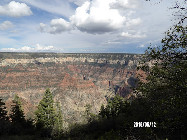
Grand Canyon North Rim.
 

These are pictures of Roaring Springs Canyon


This is a little hike down to Bright Angel.


Just your run-of-the-mill tree growing out of a rock with the Sun and clouds behind it.


Kathy posing with the tree


The clouds were coming and it was getting really dark.
We just ran out of time today.
We have to come back and explore more of the North Rim.

We must of seen 100 deer on the way out of the park.
If you roll your window down and say HI !


The Deer will give you a heads up!


Who doesn't love a sunset.


We will definitely will be back Page, Arizona. There is a lot for us to do here still.

Our 4th grandchild will be here a little early.
We're headed down south to Casa Grande to hang out for a month.


Saturday, June 13, 2015

Arizona - Grand Staircase National Monument - Off Road Adventure / I high centered the Jeep

The Grand Staircase - Escalante National Monument


This is a US National Monument protecting 1,880,461 acres by the Bureau of Land Management. For more information about dinosaurs spotted in the area click here.

We did a little off road'n in the area check out these pictures.


We started off on the Smokey Mountain Road #230,


Then we took the Crosby Canyon Road #231 toward Lake Powell


Creepeee


This is a shot of our navigation on the Jeep which clearly shows our position in Lake Powell.


This can only be accomplished because the lake is low.


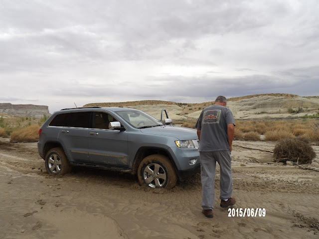
Back to the road and now the wheels are spinning,
out of the Jeep and into the mud to check it out.
Got back in the Jeep and put it in Grandma,
as Dad would say,
4LO and 2nd gear and crawled out.


On the way back up the road Kathy got this shot.


As we continue on this road our plan is to take Smokey Hollow Road #330 to Smoky Mountain Road #300 and back.

We had stopped by the Big Water visitors center and picked up a road condition sheet for the area.
I should probably have read it.
It said this about Smokey Hollow Road #330, it said it was impassible, dated two days earlier.


This is called "high centering" the Jeep.


 A lot of this trail was nice road but the problem was the road crossed the wash several times as we went through the canyon.
The problem was climbing out of the washes in some places.


Luckily we had an off road tool bag. 
See that yellow bag? It has a shovel, sledge hammer,
pick, ax and telescoping handle in it,
Don't leave home without it.


Luckily it was only sand that I had to dig out,
if it were dirt and rocks we would had been in trouble.
I think the delay took us about 30 or 40 minutes.


This where we got stuck, (X) marks the spot.
We didn't give up, Kathy didn't complain.
Our navigation unit on the Jeep show us were the road was crossing the wash.
So in the photo we just backed up a little bit headed East in the wash, then North to the next entrance and continued.


This off road experience rated #2 in my book it was very technical and got my adrenaline going digging us out.

Our #1 would be switch backs on the Shafer Trail Mohab Utah.


It's not technical but you better be on your toes.


This trail is extremely steep and it travels along the tops of sheer cliffs.

Anyway back to the present, here I am pre checking the trail.


Bear!


Black tailed Jack Rabbit


We had lunch and continued on to Smoky Mountain Road #300 back to highway 89.


Kelly Grade Overlook.
Just starting to rain.


I think we covered about 44 miles in five and a half hours.
We mad it back safe and sound.

Thursday, June 11, 2015

Arizona - Glen Canyon Dam - Lake Powell - Horseshoe, look no hand rails - Rainbow Bridge National Monument

Glen Canyon Dam & Lake Powell

Glen Canyon Dam is a concrete arch dam on the Colorado River in northern Arizona, near the town of Page.

The dam was built to provide hydroelectricity and flow regulation from the upper Colorado River Basin to the lower. It took 10 years to build it.


At the time of its completion in 1959, the Glen Canyon Dam bridge was the highest arch bridge in the world and the second highest bridge of any type.


Its reservoir is called Lake Powell, and is the second largest artificial lake in the country,
extending upriver well into Utah.


The dam is named for Glen Canyon, a colorful series of gorges,
most of which now lies under the reservoir

Horseshoe Bend is a horseshoe-shaped meander of the Colorado River located 5 miles downstream from the Dam.


It is accessible via hiking a 1.5-mile round trip from US Route 89. Horseshoe Bend can be viewed from the steep cliff. This is as close as I dared to go.
Its 1,000-foot drop with No Handrails for visitors.


Rainbow Bridge National Monument is in southern Utah.
Rainbow Bridge is often described as the world's highest natural bridge.
Right now the lake is about 101 feet low from its maximum holding capacity as you can see in this picture


   To get there you take a two-hour boat ride on Lake Powell from either one of two marinas near Page, Arizona,


Now you hike 1.25 mile from the dock. This would all be under water.


This is were the water would come up to if the lake wasn't down.


The other way of getting to the bridge is by hiking several days overland from a trailhead on the south side of Lake Powell.
To do this you must obtain a permit from the Navajo Nation in Window Rock, AZ.